
www.esri.com/about/newsroom/blog/duke-maps-models-right-whale-movement
Preview meta tags from the www.esri.com website.
Linked Hostnames
16- 19 links towww.esri.com
- 2 links toseamap.env.duke.edu
- 2 links towww.earthspecies.org
- 2 links towww.fisheries.noaa.gov
- 1 link toblog.cwf-fcf.org
- 1 link tomgel.env.duke.edu
- 1 link totwitter.com
- 1 link tousa.oceana.org
Thumbnail
Search Engine Appearance
https://www.esri.com/about/newsroom/blog/duke-maps-models-right-whale-movement
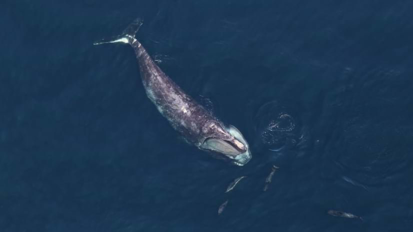
Saving the North Atlantic Right Whale: Marine Spatial Planning and Awareness
Duke University's Marine Geospatial Ecology Lab uses data and mapping to protect endangered North Atlantic right whales.
Bing
Saving the North Atlantic Right Whale: Marine Spatial Planning and Awareness
https://www.esri.com/about/newsroom/blog/duke-maps-models-right-whale-movement
Duke University's Marine Geospatial Ecology Lab uses data and mapping to protect endangered North Atlantic right whales.
DuckDuckGo
https://www.esri.com/about/newsroom/blog/duke-maps-models-right-whale-movementSaving the North Atlantic Right Whale: Marine Spatial Planning and Awareness
Duke University's Marine Geospatial Ecology Lab uses data and mapping to protect endangered North Atlantic right whales.
General Meta Tags
15- titleMapping to Save the North Atlantic Right Whale
- charsetUTF-8
- X-UA-CompatibleIE=edge
- viewportwidth=device-width, initial-scale=1.0
- last-modified7/30/2024
Open Graph Meta Tags
8 og:localeen_US
- og:typearticle
- og:titleSaving the North Atlantic Right Whale: Marine Spatial Planning and Awareness
- og:descriptionDuke University's Marine Geospatial Ecology Lab uses data and mapping to protect endangered North Atlantic right whales.
- og:urlhttps://www.esri.com/about/newsroom/blog/duke-maps-models-right-whale-movement/
Twitter Meta Tags
4- twitter:cardsummary_large_image
- twitter:site@Esri
- twitter:label1Est. reading time
- twitter:data110 minutes
Link Tags
32- EditURIhttps://www.esri.com/about/newsroom/xmlrpc.php?rsd
- alternatehttps://www.esri.com/about/newsroom/wp-json/wp/v2/blog/683652
- canonicalhttps://www.esri.com/about/newsroom/blog/duke-maps-models-right-whale-movement/
- dns-prefetch//www.esri.com
- dns-prefetch//webapps-cdn.esri.com
Links
37- http://www.esri.com
- https://blog.cwf-fcf.org/index.php/en/right-whale-mortality-report
- https://mgel.env.duke.edu
- https://seamap.env.duke.edu/models/Duke/EC
- https://seamap.env.duke.edu/models/mapper/EC